
Vancouver has some amazing waterfalls
There is something about the allure of a waterfall. The way it cascades over the edge into oblivion. The deep rooted rumble that you can hear long before you see the falls, and the mist that rises up and lands on your face.
I have always been drawn to water, I know I am not alone when saying that. This year has been filled with a lot of local exploration, after all I am attempting something I have never done before, fulfilling my New Year’s resolution.
These 9 hikes are all easily accessible, and beautiful. You don’t need to be an advanced hiker to visit them, just make sure you bring a day pack with some water, snacks, bug spray and make sure to tell someone where you are going, and when you plan on arriving home. And last but certainly not least, you will be out in the wilderness and in saying that there will be wild animals around. Should you encounter a bear or cougar, be prepared and know what to do.
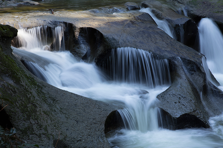
Saw Blade 8kms round trip
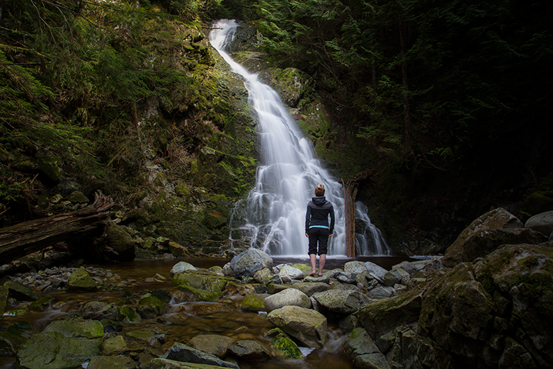
This is a lesser known falls located on Burke Mountain in Coquitlam. The hike to the falls is an easy 8kms and will take you about 3 hours to complete it. Starting out on Harper Road near the gun club, pass through the yellow gate and take an immediate left. Follow this trail for about 15min until it reaches a gravel logging road, turn left and follow this trail back into the forest. You will eventually reach the BC Hydro power lines with a road that runs under them, take this road to the left and over Pritchard Creek (bridge). Continue for about another 10 mins and eventually you will see some blue trail markers on the right-hand side that lead you into the forest. This area is quite well marked with blue markers. Eventually, you will reach a junction that goes left or right. Going left will lead you to the Woodland falls, and going right will lead you to Saw Blade Falls. Following this trail up the steep incline and several switchbacks, through the forest and up the hillside until you cross over an overgrown logging road. On the left, you will see the remnants of an old log bridge. Cross the road and you will see a few signs pointing you towards to the falls. You can climb down the side of them.
To return you can either double back the way you went or walk back to the old logging road and follow it all the way down. Eventually, it will cross over the BC hydro road and back down to another logging road. Follow this to the yellow gate. It’s a faster, less scenic way down.
Because of the close proximity to the Gun Club at the end of Harper Road, this trail can be quite loud with gun shots during the weekend. It’s not until you reach the BC Hydro service road that you will no longer hear the shots.
Nor Van Falls 14kms round trip
Located in Lynn Headwater park, this is a fairly easy, but long trek to these falls ( 14kms). The trail is well maintained with markers and a worn path as you follow the river for awhile and then the trail turns into the forest. This hike can be VERY busy in the summer months so be prepared for a lot of people, and people with dogs.
Start out at the parking lot until you reach the main area. Make sure to put your name down on the day hike list and take the bottom section with you. You will return this to the box on your way back out of the park.
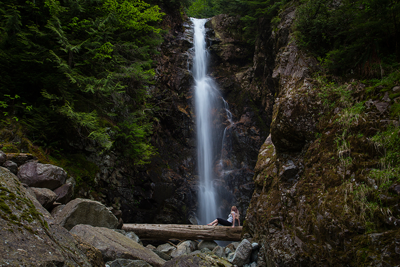
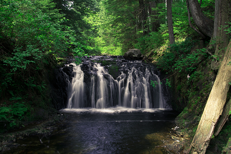
Crystal Falls 7kms round trip
A fantastic hike located in Coquitlam. This hike is approx 7kms (2 hours) and will take you along the river for the first bit and then will lead you into the forest. Once you reach the falls you can cross the river and continue following the trail if you want. The trails are really maintained and easy to follow, but just be careful you pay
Park your car along the street at Karly Cres in Coquitlam, you will immediately see the trail head. The trails are really maintained and easy to follow, but just be careful you pay attention to the trail on your way back as there are a few branches leading away from the main trail. I find if you stick to the right it’s hard to get lost.
Upper & Lower Gold Creek Falls
Both of these falls are located at the north end of the park and begin at the North Beach parking lot. This area of the park is extremely busy in the summer months. I suggest you arrive early to find parking and the lots are often closed off once they reach capacity.
Lower Falls Gold Creek 5.5kms round trip

A very easy relatively flat hike with wide well-maintained gravel paths (3kms). This hike is perfect for those who are looking for beautiful scenery or those with small kids.
Start by parking your car in the north beach parking lot and look for the trail head. One trail leads to the beach at Auloeet and the other starts a gradual climb into the forestOnce you reach the lower falls there is an outhouse ( although it was disgusting last time I was there), as well as a viewing platform to take photos.
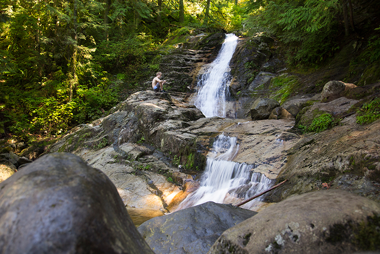
Upper Falls Gold Creek approx 9kms round trip
There are two ways to reach this location, both originate in the parking lot;
- Follow the instructions above, once you get to the top viewing platform of the upper falls you will notice an orange marker on the right-hand side going up the hill. This path is referred to as the ‘goat trail’. It’s a very steep narrow path that leads up to the East Canyon trail. Once you reach the East Canyon trail turn left and follow the old logging road for approx .5kms where you will eventually see another marker on the left-hand side. Take this trail to the left and follow the markers.
- Starting in the parking lot look for the East Canyon Trail. The trail will take you up an old logging road and through the rainforest. This road can become a river in the wetter months to make sure you bring proper footwear. Keep following the road up and past an old open yellow gate. Eventually you will see a giant pile of rocks with a little pink marker on the left ( this is the goat trail to the lower falls), keep walking for another .5kms or so and you will see another marker in a tree on the left. This is the trail to the lower falls.
Once you take the turnoff, there is a lot of scrambling over old slippery logs and moss, as well as a few super marshy places before you reach the upper falls. The incline heading down to the falls is fairly steep in some sections. Please use extreme caution in this area as the rocks and soil can be unstable, and you don’t want to get to close to the falls when it’s spring run off as the water volume increases substantially.
Un-named at Brother Creek Loop 7kms

Brother’s Creek Loop is located in West Vancouver and is a stunner of a trail. After finding parking on the street, you will see the access to the trail beside a blue fence owned by British Pacific Properties. The trail starts off with a gentle grade that will take you over old remnants of wooden rail ties that were used when the area was logged in the 1930’s. After a short distance, you will come to the Baden Powel Trail sign, do not take this trail but continue to your left until you come to the next junction. This time go right and follow the Brother’s Creek Fire access road up your hill. On the way up you will see more remnants of the logging operation that used to be there. Keep following the road up and up and be on the lookout for a little sign that says 5+6, this will be a short side trail to the Candelabra Fir tree that is over 60m tall. Head back to the Fire access Trail which will lead you through heaps of stunning old growth trees. Eventually, you will reach the picturesque Brother’s Creek Loop Bridge, cross the bridge and you will be able to see some views of this beautiful waterfall.
Cascade Falls 0.5km round trip

Located in Mission, this area just recently had a new suspension bridge installed that gives you unparalleled views of this stunning falls. Begin by parking in the lot ( has outhouses as well), and follow the trail upwards. This is a short 15min walk up a very well groomed path to the suspension bridge. There is also a logging road that will lead to the same location.
Cliff Falls park 4kms round trip (entire park)
A very easy hike located in Maple Ridge, this area has several falls and several vantage points. Depending where you start your trek, hiking the entire park is about 4kms but is an easy hike great for families or *dog walkers.
* Please make sure you dog is ALWAYS on a leash when close to the falls. I watched a dog go over the edge last year and they had to call search and rescue to come and get him. Thankfully he was rescued and is now safe and sound.
Rolly Lake Falls 3km round trip
Located In Mission Rolly Lake is a great spot to spend the day. This park has a great area for a picnic, a fantastic calm lake, and a great trail that wraps the shores. Starting in the parking lot take the trail towards the right ( counter clockwise), you will pass some outhouses and then have great views of the forest on the right, and the lake on the left. There are several spots to stop along the lake. Keep following the trail until you eventually reach a bridge on the left side crossing a creek. Do not cross this bridge but continue to follow the trail eventually going up a hill and into the campsite. There is an outhouse on your left and right behind the outhouse is another trail opening, follow this. It will lead you a short distance to a cute little wooden bridge with a fantastic view of the falls. You can stop here, or continue over the bridge and down further for a second more impressive view of the lower falls.
Bridal Veil Falls .5km round trip

Located in Chilliwack this falls offers on heck of a view when passing through the area. The waterfall is an impressive 60meters high and hugs the wall as it tumbles to the ground and creates several smaller stream like waterfalls. The hike to the falls is a short 15ms but it can be steep in sections. Although this location is somewhat off the beaten path, I think it’s a must if you are in the area and is a great spot to stop and stretch your legs after a long drive.


Subscribe To My Newsletter
Join my mailing list to receive the latest news and updates.
You have Successfully Subscribed!